In 2019, the Northwest Area Committee convened a Taskforce to address this GRP accessibility by finding out more about who uses GRPs and how they use them. The Taskforce developed a survey that generated valuable feedback around GRP best practices, common users, and ways to innovate the GRP development and publication process. A key outcome of the survey for Washington is the new GRP format hosted on this website. This change was important to address the efficiency and sustainability of GRP development today and into the future.
We recently reformatted the Snake River – Ice Harbor Pool GRP and the San Juan Islands GRP into this new format. The new online format allows users to easily scroll through text-heavy narrative sections like Site Description and Resources at Risk, while also maintaining the valuable PDF format of the response-oriented sections like Response Options and Considerations and the 2-Pagers.
Also included in this format update are special non-floating oil (NFO) considerations, including a new section on Non-Floating Oil Response Options and Considerations and updates to section six – Resources at Risk. . NFO considerations, spill-specific modeling, and other information can be found on this new interactive map.
We believe this format addresses many of the accessibility concerns of the response community, but we would love to hear your ideas on how we can make it better. Please submit your comments, questions, and suggestions for improvement to GRPs@ECY.WA.Gov.
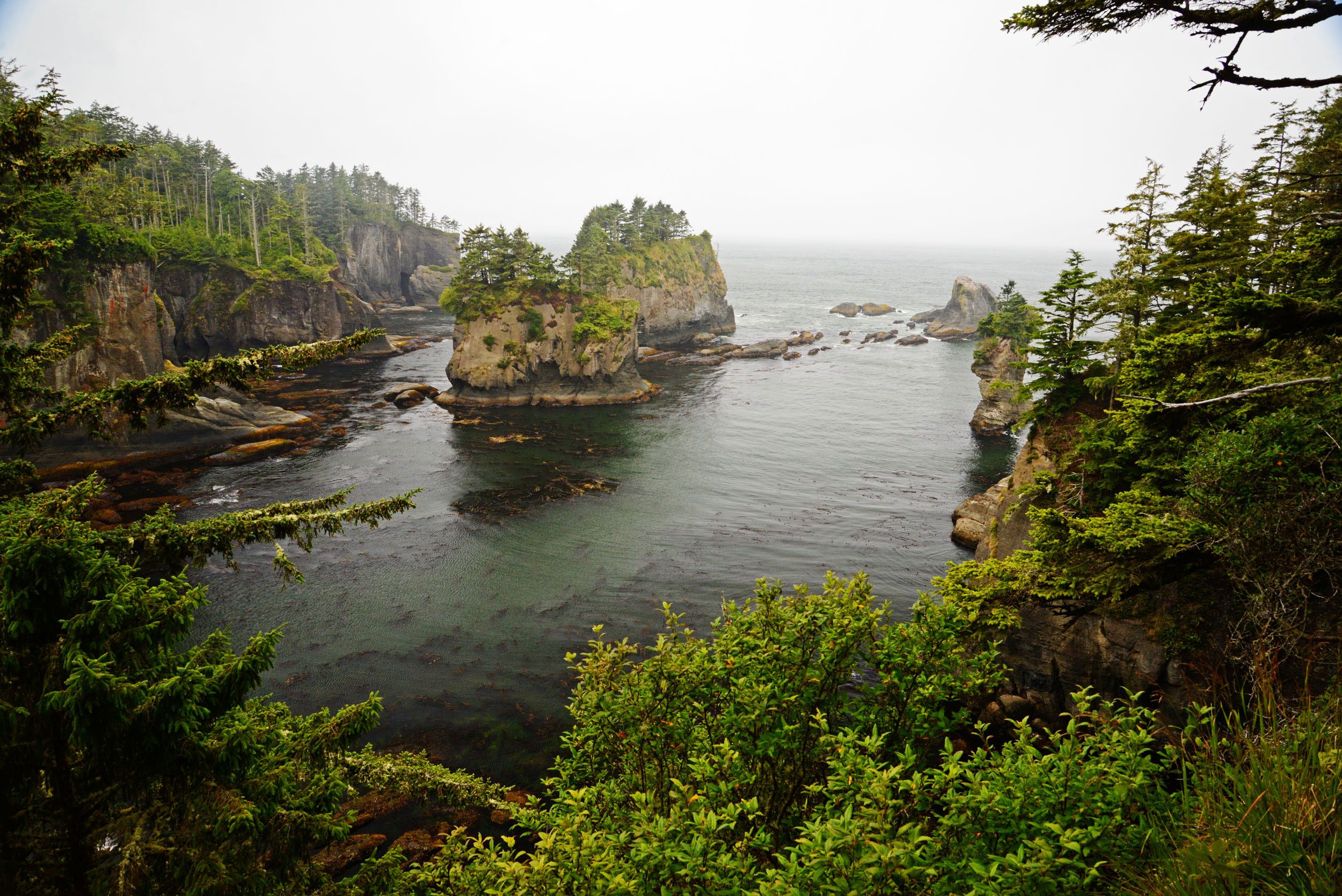
The South Puget Sound GRP is now available in the online format and with new language data on non-floating oil!
In 2019, the Northwest Area Committee convened a Taskforce to address this GRP accessibility by finding out more about who uses GRPs and how they use them. The Taskforce developed a survey that generated valuable feedback around GRP best practices, common users, and ways to innovate the GRP development and publication process. A key outcome of the survey for Washington is the new GRP format hosted on this website. This change was important to address the efficiency and sustainability of GRP development today and into the future.
We recently reformatted the South Puget Sound GRP into this new format. The new online format allows users to easily scroll through text-heavy narrative sections like Site Description and Resources at Risk, while also maintaining the valuable PDF format of the response-oriented sections like Response Options and Considerations and the 2-Pagers.
Also included in this format update are special non-floating oil (NFO) considerations, including a new section on Non-Floating Oil Response Options and Considerations and updates to section six – Resources at Risk. Area specific NFO considerations include heighten risks in Upper Case Inlet; Budd, Eld, and Totten Inlets; Devils Head; and, Peale Passage.
We believe this format addresses many of the accessibility concerns of the response community, but we would love to hear your ideas on how we can make it better. Please submit your comments, questions, and suggestions for improvement to GRPs@ECY.WA.Gov.
Geographic Response Plans (GRPs) act as the initial guidance for oil spill responders during the early hours of a spill. They include response land-based strategies to protect sensitive cultural, economic, and environmental resources from spilled oil. These plans are the compilation of many data relating to response and are merely one part of a much larger and detailed plan.
In 2019, the Northwest Area Committee convened a Taskforce to address this GRP accessibility by finding out more about who uses GRPs and how they use them. The Taskforce developed a survey that generated valuable feedback around GRP best practices, common users, and ways to innovate the GRP development and publication process. A key outcome of the survey for Washington is the new GRP format hosted on this website. This change was important to address the efficiency and sustainability of GRP development today and into the future.
We reformatted the Grays Harbor GRP as an example of the new format. The new online format allows users to easily scroll through text-heavy narrative sections like Site Description and Resources at Risk, while also maintaining the valuable PDF format of the response-oriented sections like Response Options and Considerations and the 2-Pagers. We believe this format addresses many of the accessibility concerns of the response community, but we would love to hear your ideas on how we can make it better.
Please submit your comments, questions, and suggestions for improvement to GRPs@ECY.WA.Gov.
In collecting data to determine which oils may submerge or sink because their densities are heavier than water or may become denser the longer they remain in the water, we reviewed the types of oil listed in Washington-approved oil spill plans, the conditions encountered in the many types of Washington waterways, as well as lessons learned from historical spills. We used information from “Advance notice of Transfer” data, oil spill contingency plans (oil types and properties), the Northwest Regional/Area Contingency plans, contractor certification guidance and technical reference documents to identify these oil types:
Crude oils.
Heavy fuel oils.
Vacuum gas oil.
Used and waste oils.
Asphalt and asphalt products.
In an earlier blog, we wrote that we also need to know the characteristics of the water bodies and examine the characteristics could lead oil submerging or sinking, such as the turbulence or sedimentation. This type of information will be added to our planning tools.
What are the updates to the content of the Geographic Response Plans (GRPs)?
GRPs and the tactical booming strategies contained in the plans are an important part of the readiness for oil spills in the Pacific Northwest region. In order to update the GRPs to address risks from non-floating oils we are adding new information “Non-floating Oils Response Options and Considerations” (Example, Grays Harbor GRP NFO Response Options) as well as updates to Section 6 – Resources at Risk (Example, Gray Harbor GRP Resources At Risk) from spills. We will be using this site to preview updates to GRPs as we develop them.
We want your feedback!
Our GRP update relies on information and planning guidance from key reference documents. Please let us know if there are other tools you think we should mention. These tools may support our preparedness planning or real time considerations during a response. Please email grps@ecy.wa.gov.
Contributed by Washington Department of Fish & Wildlife
Spilled oil can be devastating to fish and wildlife. Floating oils impact animals at the water’s surface while non-floating oils can threaten underwater habitats and species. Unfortunately, there is no way to capture and rehabilitate animals living underwater that get affected by spilled oil.
Cleaning up oil in underwater habitats is difficult. Removal of sunken oil generally requires dredging out some of the sediment material on the bottom of the river, stream, or lake. Oil on logjams or tree roots in the water may be particularly difficult to locate and removing the oil may cause more harm than good.
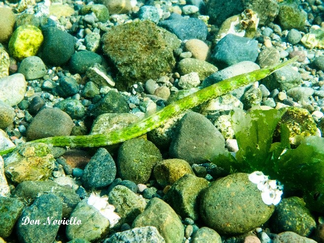
Freshwater habitats include lakes, rivers, streams, and wetlands. These habitats are home to about 67 fish species in our state, including one species found only in Washington – the Olympic mudminnow.
Numerous mammals, birds, amphibians, reptiles, and insects rely on freshwater habitats to survive and thrive. Developing fish eggs are particularly sensitive to the effects of oil contamination. Sunken oil also has the potential to kill aquatic vegetation, which can greatly disrupt ecosystems that rely on these plants.
Benthic organisms are animals that live on the bottom of a lake or river, and include organisms such as crayfish, freshwater mussels, snails, sculpin, catfish, and insect larvae. These animals can be smothered by pools of sunken oil.
Other animals in the food web that rely on benthic organisms for food can consume toxins when they eat contaminated prey or aquatic vegetation. For example, mammals such as beaver, muskrat, and river otters frequently dive and forage for food below the water’s surface. This behavior places them at risk from non-floating oils that are in the water column or on the bottom. Likewise, birds that dive or spend large amounts of time wading in water such as diving ducks, heron, and dippers are at risk of getting contaminated with non-floating oil.
The beds in Washington’s freshwaters can generally be categorized by their sediment type:
Fine sediments (mud/silt/sand) accumulate in slow or still water, or, pools. Sunken oil will tend to settle, collect, and remain in fine sediment habitats. During times of low water flow such as late summer or during a drought, pools serve as refuge for fish and mobile aquatic invertebrates and these pools may collect sunken oil. Aquatic vegetation such as lily pads, cattails, and submerged vegetation is frequent in fine sediment habitat. This habitat supports both warm-water fish such as bass, Olympic mudminnow, catfish, and cold-water fish such as trout and salmon. Other species that use this habitat include lamprey larvae, dabbling ducks, muskrat, beaver, California floater, frogs, newts, northwestern salamanders, and turtles.
Great blue heron (Ardea herodias) and turtles in a pond with a fine sediment bottom. Photo by Amy Hallman.
Rough-skinned newt (Taricha granulosa) prefer slow or still water such as this pond with a fine sediment bottom. Photo by Jim Cummins.
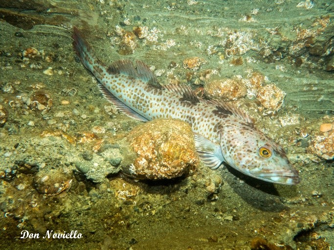
Coarse sediments (gravel/cobble) are found in moderately moving water with larger grain-sized bed materials. Aquatic vegetation may or may not be present. Gravel beds can provide spawning habitat for anadromous and resident salmonids such as rainbow, cutthroat, bull trout, salmon, and steelhead. The turbulent water may suspend finer sediment material which can mix with non-floating oils and can cause the oil or settle where the water slows such as in backwater eddies, side channels, undercut banks, and logjams. This habitat also supports both warm and cold-water resident fish, beaver, harlequin ducks, western pearlshell mussel, crayfish, and tailed frogs.
Bull trout (Salvelinus confluentus) is a char native to the northwest that prefers habitats with coarse sediment and moderately moving water. Photo by Eric Anderson.
Adult lamprey (Petromyzon sp.) spawn in river gravels. Photo by Kevin Fox.
Bedrock tends to be found in fast water and contains little or no deposition of fine or coarse sediments. Aquatic vegetation is uncommon in this habitat. During high flows non-floating oil is likely to be flushed through this habitat to an area and may leave a film of oil on the bedrock. This habitat supports cold-water fish, American dippers, harlequin ducks, and torrent salamanders.
American dippers (Cinclus mexicanus) dive in fast-moving rocky streams to feed on benthic invertebrates. Photo by Jim Cummins.
Torrent salamanders (Rhyacotriton sp.) can be found in mountain brooks, seeps, and the saturated splash-zone of streams. Photo by Allison Cook.
Contributed by Washington Department of Fish & Wildlife
Oil can harm or kill fish and wildlife no matter where it is located in the water. Floating oils impact habitats and animals at the water surface. Non-floating oils impact habitats and species in the water column and the sea floor and there is currently no means of capturing and rehabilitating the animals in these areas. In addition, many of the tools used for removing sunken oil can also impact these organisms.
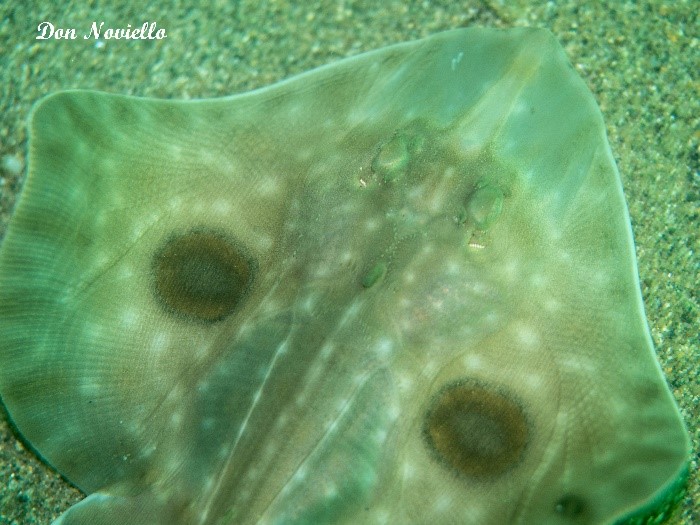
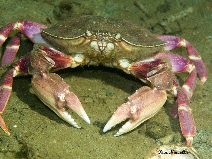
The water column and sea floor support a variety of animals. Benthic organisms are those animals that live on the sea floor. Crab, shrimp, clams, and sea stars are examples of benthic organisms. The world’s largest octopus, sea star, moon snail, and burrowing clam (geoduck) are some of the unique benthic animals that reside in Washington’s marine waters. Benthic animals are at risk of being smothered or entombed by pools of sunken oil. They can also be harmed by ingesting or absorbing toxic compounds from the oil. In addition, developing fish eggs are also particularly sensitive to the effects of oil contamination in the environment. Other animals in the food web that eat benthic organisms can consume toxins when they eat contaminated prey.
Sinking oils also come into contact with fish and wildlife as the oil sinks through the water column. Diving birds, marine mammals, salmon, and other animals that spend time in the marine water column can become oiled or ingest oil while the oil is in the water column.
Eelgrass meadows and kelp forests are some of the aquatic vegetation communities that provide important habitat for a variety of animals including seabirds, fish, and sea otters. Sunken oil has the potential to kill aquatic vegetation. If this happens, it can disrupt ecosystems that rely on these plants from the sea floor up to the water’s surface.
The sea floor types in Washington’s marine waters can generally be categorized as: soft sediments, rock reefs, boulder and cobble fields, or non-hard rock walls. Each of these is composed of different materials and support a different assemblage of organisms.
Soft sediment includes clays, mud, sand and gravel. Animals that tend to live on the surface in these habitats can include sea cucumbers, sea stars, crustaceans such as crab and shrimp, and bottom fish such as skate, cod, and the flat fishes.
Soft sediment habitats also support shellfish and other invertebrates including bivalves, worms, brittle stars, and shrimplike crustaceans whose burrowing or foraging activities can penetrate up to one meter below the subsurface bottom. In deeper waters, this habitat type may also include sand fields that serve as necessary overwintering habitat for sand lance, and environmentally critical forage fish.
A big skate (Raja binoculata) living on soft sediments in south Puget Sound.
Graceful crab (Cancer gracilis) one of many crab species that frequent soft sediment habitats.
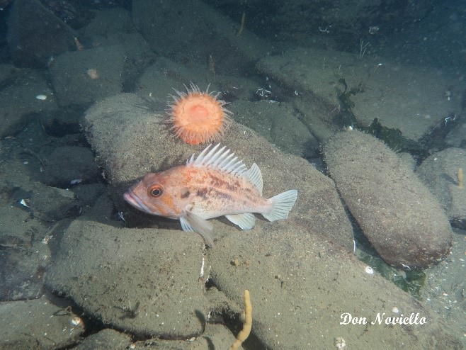
Rock reefs serve as important habitat for a wide range of species including mobile invertebrates (e.g. snails, sea slugs, sea cucumbers, sea stars, etc.) and immobile species (e.g. anemones, barnacles, shellfish, sponges, tubeworms, etc.). Macro algae like nori, bladderwrack, and Turkish towel are found in this habitat as are the larger kelps such as bull, giant, and sugar. These various “sea weeds” provide important food and shelter for many organisms. The crevices and overhangs associated with reefs serve as valuable habitat for a wide variety of other species such as crabs, shrimp, octopus, wolf eel, rockfish, and lingcod. If located within their capabilities to dive, these areas may also serve as important foraging areas for birds and marine mammals.
Rock reefs such as those near Neah Bay are particularly rich in marine life. Pictured here are a China rockfish (Sebastes nebulosus), red sea urchins (Mesocentrotus franciscanus), rainbow (Orthasterias koehleri) and blood (Henricia species) sea stars and a rose (fish-eating) anemone (Urticina piscivore) along with other encrusting life forms.
Giant Pacific octopus (Enterotopus dofleini) inhabiting a crevice on a rock reef in Hood Canal.
Many marine organisms may live on or between the cobble stones and predatory species often utilize these habitats as foraging areas. As with the rocky reefs, these habitats serve as important foraging areas for birds and marine mammals if they are located within a species ability to dive. Depending on how much sediment the currents move through the area the spaces between the rocks may be filled with sediment that can also support bottom dwelling life forms.Boulder and cobble fields provide many of the same ecological functions described for rock reefs while the spaces between boulders offer enhanced spaces for refuge of benthic invertebrates and fish.
Brown rockfish (Sebastes auriculatus) and swimming anemone (Stomphia didemon) inhabiting boulder field in Hood Canal.
Bay pipefish (Syngnathus leptorhynchus) observed on a large gravel and cobble sea bottom area. More typically found in ell grass bed pipefish also at least occasionally forage in cobble habitats.
Non-hard rock walls are the result of the glacial origin of the Puget Sound basin. There are numerous areas of steep consolidated glacial deposits, particularly in the vicinity of the Tacoma Narrows and Colvos Passage. These structures function much like rock reefs but have a more penetrable surface as animal activity and erosion create temporary pockets in the surface. The biota of these habitats is similar to that of rock reefs except that long-lived, immobile life forms (such as sea anemones) may be less abundant due to the sloughing of the wall surface.
Brown rockfish (Sebastes auriculatus) resting on a non-hard rock wall composed of composite clay and rock sediments off Day Island near Tacoma in South Puget Sound.
Lingcod (Ophiodon elongatus) perched on a non-hard rock wall off Day Island near Tacoma in South Puget Sound. From this position the ambush predator may strike a passing fish such as herring.
We are planning for potential NFO response by analyzing the properties of Washington’s waterways including depths, water density, sediment load, currents, seafloor substrate types, and shoreline types. Areas of relatively higher risk would represent locations where sunken oil may collect and maybe areas of focus for surveys after a spill of heavy oil or after observations of oil weathering and some portion sinking during a spill. The stage of risk assessment in our planning is not a guarantee that oil will submerge or collect in these areas or that these conditions will definitely cause the oil to sink that is otherwise floating. But we are considering:
Water density: If spilled oil is denser than the receiving water, it sinks. Heavy oils spilled to less dense water or freshwater may result in the oil sinking more quickly.
Water turbidity: Turbulence can result in sedimentation that increases an oil’s density causing it to submerge or sink. High turbidity in the waterway may result in the formation of oil mineral aggregates which may result in sedimentation and sinking of the oil.
Waterway currents: Slower currents may allow submerged oil to sink.
Substrate composition: Mud is found in low-energy areas, where sunken oil may settle, collect, and remain in place.
Shoreline composition: Sediment mixing happens by oil stranding on a shore and mixing with sandy sediments or by mixing with sediments in the water column by wave action. Wave interaction with sandy beaches can mix sediment into the spill and may result in the formation of tar balls and sinking oil.
Salinity: Oil is more likely to sink in freshwater, but may refloat in saltwater. We will look for major sources of freshwater in our planning areas which could change the salinity during certain seasons.
Temperature: Temperature affects the density of oil and slows oil weathering; higher temperatures cause lower oil densities and faster weathering (evaporation). Lower temperatures increase density and reduce evaporation rates. Oil is more likely to sink in cold water. Seasonal temperature changes are more significant than geographic temperature changes in this planning area.
Sinks: Sinks can be identified using bathymetry data. Sinks are areas where oil may collect if it sinks.
Next blog – A detailed identification of sensitive water column and benthic species at risk.
Non-floating Oils – Risk Assessment Planning for NFO response begins with assessing the properties of the oils listed in oil spill plans, and determining which of those oils have properties (or historical precedence) of submerging or sinking when spilled. You can use the Spills story map to see where the pipeline and rail corridors in Washington are, where oil is shipped and where transfer facilities exist in the state. Oil spill plans contain details about the properties of oil at these various locations.
Early Assessment Guidance When oil spills, an initial assessment needs to be made during the early hours focused on the oil properties. Our new rules require industry to make that assessment and consult with the agencies that are responding to the spill. Ongoing observations and data collection will tell us how the oil weathers and behaves in the environment. The NOAA ADIOS weathering model may be used to help predict how the oil product will change over time.
Next time – what do we know about the properties of the water bodies in Washington that could affect whether oil floats or sinks?
We know that heavy oil such as asphalt is likely to sink, but what about oils left in the environment – will they eventually submerge or sink, and when? Knowing the possibilities, where, when and why oil may sink help us plan better response actions. This blog establishes a place to have a dialogue with communities, responders, and technical experts to understand the challenges of spill response, learn more about the Washington environment and share information on how oil acts when spilled.
What do we know?
We know that when an oil is “non-floating” we mean one of three things. 1) Oils may submerge or sink because their densities are heavier than water, and oils may become denser the longer they stay in the water. 2) Oils may submerge in the water column when they encounter turbulence, such as currents and waves. Submerged oil may move within the water column. 3) Oils may sink when they encounter sediment as they are washing towards the shore. Oil may strand on the beach and later refloat and move on. Any one of these conditions poses challenges for us when responding to spills.
What we need to know?
We know that in Washington we are transporting oil that may not remain floating. What we need to know more about is what are the names and physical properties of those oils? Where are they being transported? In addition, we need to know the characteristics of the water bodies they are moved near and what characteristics could lead oil submerging or sinking, such as the turbulence or sedimentation. Our current oil spill planning tools need to be updated based on this information.
Manage my Subscriptions
Enter your email to receive a link to select or manage your subscriptions, or to opt-out.
Cancel
Send Subscription Management Link