Site Description
This section provides a description of the Snohomish Basin’s physical features, hydrology, climate, and winds and includes an overview of the oil spill risks in the region. The Snohomish Basin, also called Water Resource Inventory Area 7 (WRIA 7), consists of three main river systems and numerous tributaries. The headwaters of the Skykomish River and Snoqualmie River form in the mountains of the Cascade Range. These rivers flow west and converge to form the Snohomish River in the floodplains of the Snohomish Basin. The Basin drains 1,900 square miles from the west crest of the Cascade Range to Puget Sound near Everett, Washington. There are 2,718 miles of rivers and streams in the Basin (Snohomish County). It is the second largest basin draining into Puget Sound.
Open to read more
The Snohomish Basin includes the northeastern portion of King County and the south-central portion of Snohomish County. The Basin is located north and east of the Seattle metropolitan area. The North Central Puget Sound GRP neighbors the Snohomish Basin GRP to the west and north.
Snohomish River
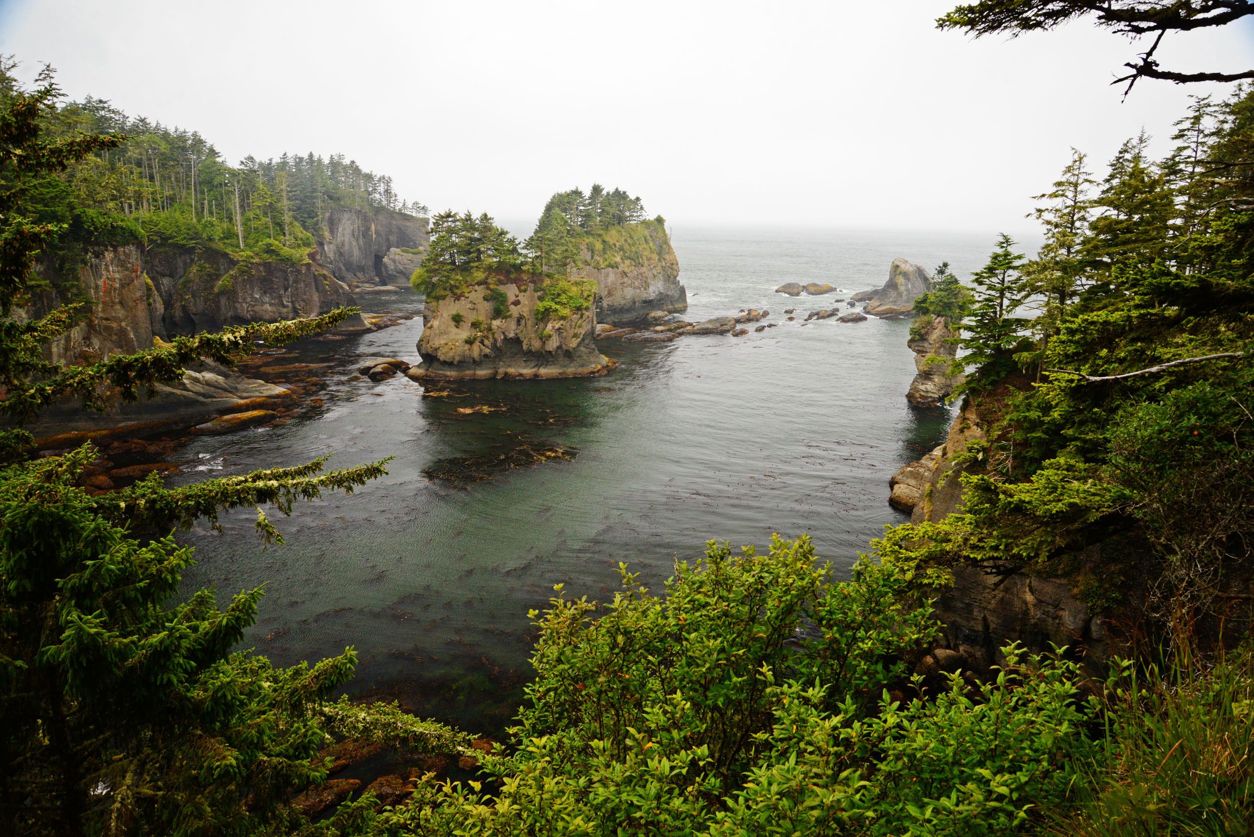
The main channel of the Snohomish begins at the confluence of the Skykomish and Snoqualmie Rivers near the City of Monroe, approximately 20 miles upstream from the river’s mouth. The river is joined by the Pilchuck River and flows past the City of Snohomish near river mile 13. As the Snohomish River Estuary forms near the City of Everett, it branches into several large braided channels: Ebey Slough along the east and north side of the estuary, Steamboat Slough and Union Slough through the middle of the estuary, and the main Snohomish River channel along the south and west side. The river outflows to Puget Sound at Port Gardner Bay near Everett at the western edge of Snohomish County.
The Snohomish Estuary is the second largest estuary on Puget Sound. Significant restoration work is reclaiming critical habitats in the Snohomish Estuary (Snohomish County). Between 2005 and 2019, over 1,620 acres of estuary were restored, more restored acres than any other estuary on Puget Sound (Snohomish County). Multiple projects are working on reconnecting off-channel habitats, improving fish passage and tidal exchange, restoring shoreline conditions, and enhancing the riparian environment, while preventing further degradation.
Skykomish River
The headwaters of the Skykomish River begin near Stevens Pass on the west side of the Cascade Crest. Washington State Highway 2 (HWY 2) and the BNSF Railway follow the South Fork Skykomish River past several small rural towns, including Skykomish and Baring. The North Fork Skykomish River drains undeveloped mountainous forestland. The South Fork meets the North Fork to form the main stem of the Skykomish River near the City of Index. The Sultan River joins the main stem of the Skykomish River near the City of Sultan. The protected headwaters of the Sultan River supplies municipal drinking water to 75% of Snohomish County residents and businesses (Everett). This water source is upstream from any significant spill threat. The Skykomish River watershed drains the Mount Baker-Snoqualmie National Forest, which includes the Wild Sky Wilderness and the Henry M. Jackson Wilderness areas. Locals commonly shorten Skykomish and refer to the river as “The Sky.”
Snoqualmie River
The headwaters of the Snoqualmie River include three forks to the main stem, the North Fork, Middle Fork, and South Fork. Interstate-90 follows the South Fork Snoqualmie as it travels west, draining the areas around Snoqualmie Pass. The Middle Fork and the North Fork drain the forested mountainous area north of Interstate-90 and the Alpine Lake Wilderness. The main stem of the Snoqualmie River begins near the City of North Bend, at the confluence of the three forks. The Snoqualmie River tumbles over Snoqualmie Falls near the City of Snoqualmie. Snoqualmie Falls, a 268-foot waterfall, is one of Washington’s most popular scenic attractions. After Snoqualmie Falls, the river meanders through farmland, past the cities of Fall City and Duvall in the river’s floodplain. The Snoqualmie converges with the Skykomish River near Monroe to form the Snohomish River.
Physical Features
Tectonic and volcanic activity, glacial movement, flowing glacial meltwater, and human development carved the physical features of the Snohomish Basin. In the headlands of the basin, steep mountain catchments, underlain with bedrock give way to broad floodplains as the rivers converge near Puget Sound. In the lowland portion of the basin, several diking and flood control districts use dikes to manage the floodplains of the Snohomish, Skykomish, and Snoqualmie Rivers to control the rivers’ flow.
Open to read more
Snoqualmie Falls on the Snoqualmie River and Sunset Falls on the Skykomish signify a break between upper-river and lower-river features. Upriver, large boulders and woody debris shape the stream channels. In the upper basin, the river channels have steep gradients and coarse channel substrate. Bedrock is often exposed. Below the falls, a gentler slope slows the rivers’ velocity through the floodplains and the channels meander. The sediment of the lower Basin consists of silt, sand, and gravel.
Land use in the Snohomish River Basin is approximately 70% forest, with roughly 50% of forested land in federal ownership (Snohomish Basin Salmon Recovery Forum). Agriculture activities use about 5% of the watershed on the rich floodplain soils of the basin. Rural residential and urban areas are the main land use in the lower basin where more than 90% of the original floodplain wetlands have been drained, filled, or channeled to make the land accessible to farming and development (SBSRF).
Tribes of the Snohomish Basin
The Snohomish Basin is within the usual and accustomed territories of a number of American Indian Tribes. The Indian reservation of the Snoqualmie Tribe is located near the City of Snoqualmie, approximately one mile south of the Snoqualmie River. The Tulalip Tribe’s reservation is location directly northwest of the Snohomish River mouth, near Marysville. Other federally recognized Tribes with access to the resources of the Snohomish Basin may include the Lummi Nation, Muckleshoot Tribe, Nooksack Tribe, Samish Nation, Sauk-Suiattle Tribe, Suquamish Tribe, Stillaguamish Tribe of Indians, Swinomish Tribe, Upper Skagit Tribe, and Yakama Nation.
Tribes can fill many roles during an oil spill response including full participation in Unified Command, providing resource specialists in the Environmental Unit, monitoring on-scene operations, and more. Information regarding tribal participation in a response is available on the Northwest Area Committee/Region 10 Regional Response Team website. Contact information for the tribes in this planning area can be found in the Resources at Risk section and on the Spill Response Contact Sheet of this GRP.
Developed Areas
The cities and towns lining the rivers of the Snohomish Basin were established in support of logging, mining, and agricultural activities in the late 1800s and the towns’ proximity to the former Great Northern Railway. Larger cities within the Basin include Everett, Marysville, Lake Stevens, Snohomish, Monroe, Duvall, and North Bend. Smaller cities and towns include Sultan, Gold Bar, Index, Skykomish, Carnation, Fall City, and Snoqualmie.
Hydrology
The region’s close proximity to the Pacific Ocean prescribes a temperate climate with cool, wet winters and warm, dry summers. River flow volumes generally peak in the spring due to melting snow packs and in the winter from increased precipitation. Low flow conditions tend to persist throughout the summer months. Precipitation varies throughout the Basin as elevation rises from sea level to 8,000 feet. Everett receives an average of 36 inches of precipitation and 7 inches of snow per year. Snoqualmie Pass at the crest of the Cascade Range averages 100 inches of precipitation and 420 inches of snow per year (Western Regional Climate Center).
Open to read more
The United States Geological Survey (USGS) provides current streamflow data and the National Oceanic and Atmospheric Administration (NOAA) provides advanced hydrologic predictions. Stations are located on the Snohomish River near Snohomish and Monroe, the Snoqualmie River near Carnation, and the Skykomish River near Gold Bar. Other gages provide data from tributaries in the Basin including the Pilchuck River, Sultan River, and Tolt River (NOAA and USGS).
Climate, Winds, and Weather
The moderate climate of the Snohomish River Basin provides warm and dry summers and mild, wet, and cloudy winters. In western Washington, rainfall is often described as drizzle, showers, sprinkles, or mist. Precipitation is typically moderate in intensity and will persist for hours to days. In Everett, precipitation is highest in December when the total average precipitation is 4.96 inches and lowest in July when the average total is 1.04 inches. Annual average temperatures range between 58.8°F and 42.4°F, with the monthly averages peaking in August at 72.7°F and fall to 33.1°F in January (Western Regional Climate Center).
Open to read more
From late spring to early fall in western Washington, onshore or offshore winds are a good predictor of the type of weather that can be expected. Onshore flow brings air from the surface of the Pacific Ocean into the region. Onshore flow usually means cooler air, clouds, fog, and the potential for light showers. Offshore flow brings in warmer air from eastern Washington, creating clear skies and warm temperatures in summer months. The warmest days in western Washington mostly occur when there is offshore flow. In the winter, the weather pattern reverses. Offshore flow brings dry cold air into Puget Sound from eastern Washington, often with clear skies and low temperatures. The transition between offshore and onshore flow can result in drastic weather changes any time of year, with strong winds and temperature changes of 10°F to 20°F degrees within a few hours. Responders should be ready for changing weather conditions. Bring warm layers, rain gear, and sun protection.
Visibility in the Snohomish Basin is generally moderate to good. However, inversions are common in the area, contributing to marine layers and low fog throughout the year. As the surface temperatures rise, the fog and low clouds lift, usually by the afternoon, and visibility improves.
Puget Sound Conversion Zone: The Snohomish Basin is often affected by a local weather phenomenon known as the Puget Sound Convergence Zone. The Convergence Zone forms when west or northwest winds are spilt by the Olympic Mountains to re-converge on the east side of the range, over Puget Sound. When the Convergence Zone forms, increased rain showers and more extreme weather develops over localized areas. Most often the Convergence Zone will form between Everett and North Seattle and move east towards the Cascade Range, causing localized weather impacts in the Snohomish Basin. On average, this effect happens twenty to thirty times a year (Cliff Mass).
Tides and Currents
On the Snohomish River, the tide influences water levels and flow as far upriver as Monroe. Tidal cycles will cause periodic reversal and bidirectional water flows in the estuary and on the Snohomish River up to the convergence of the Snoqualmie and Skykomish Rivers. Puget Sound’s tides are mixed semi-diurnal, with two daily high tides and two low tides of varying heights.
Open to read more
Typically, there is about an hour lag between high tide at Everett and high tide at the City of Snohomish. On the Snohomish, the river’s waterline can move several feet up and down the width of the shoreline over a tidal cycle. With tidal changes, the estuary will fill, submerging many of the features visible at low tide. Salt water will intrude upriver to River Mile 8, where Ebey Slough joins the main channel.
During low tides and during periods of low volume, the river can be extremely shallow, making workboat access difficult. In particular, shallow waters may limit access in the sloughs and associated tidal channels in the estuary. Above river mile 15, just downstream from Thomas’ Eddy, portions of the river may be inaccessible to boats launched from Snohomish because of shallow water conditions, especially during low tides and low flows. High tides may conceal debris, old pilings, and logs just beneath the water’s surface. Workboats in the estuary may not be able to navigate under bridges at high tides because of low clearances. Responders should use caution when navigating river channels. Check river volumes and tides before deploying to the field. Tidal predictions for Everett are provided by NOAA (NOAA).
Risk Assessment
There are numerous oil spill risks within the Snohomish River Basin including, oil transport infrastructure such as pipelines, railways, highways, Navy activities at Naval Station Everett, and shipping and marine activities at the Port of Everett, among other risks. A spill could significantly impact public, environmental, and economic health, as well as cultural, historical, and natural resources.
Open to read more
Oil Types: Both refined petroleum products and crude oil are transported in bulk within this planning area.
Crude oil and refined products contain a mix of hydrocarbons with varying properties; different types of crude oil and refined products will behave differently when spilled. Recent changes in oil production have led to an increase in the movement of Bakken light crude transported through the planning area via rail, and diluted bitumen from Canada transported through the planning area.
Crude oil from the Bakken fields in North Dakota has properties similar to gasoline or diesel, and poses a higher risk of fire because much of it will evaporate quickly into flammable vapors. Unlike gasoline, the heavier hydrocarbons in crude oil will persist in the environment after the light ends evaporate or burn. Bitumen from the oil sands in Alberta, Canada, is heavy, almost asphalt-like, until mixed with lighter oil products known as diluents to create diluted bitumen. Once mixed, the diluted bitumen will initially float on water after being spilled. Environmental conditions, such as the density of the receiving waters and sediment load of the receiving waters, will affect how long diluted bitumen floats. As the light diluents evaporate, the remaining heavy constituents may sink into the water column. There are specific response actions recommended for non-floating oils, detailed in the Non-Floating Oil Spill Response Tool in the Northwest Area Contingency Plan (NWACP), Section 9412.
Pipelines: Olympic Pipeline consists of over 400 miles of petroleum product pipeline. The pipelines extend from refineries in Northwest Washington and run parallel to Puget Sound and Interstate-5 to Portland, Oregon. The pipeline transports various grades of unleaded gasoline, aviation turbine fuel (kerosene), and diesel fuel. It delivers fuel to Harbor Island in Seattle, Seattle-Tacoma International Airport, Renton, Tacoma, Vancouver Washington, and Portland Oregon. No delivery sites or pumping stations are within the boundary of the Snohomish Basin. BP Pipelines North America owns and operates Olympic Pipeline. BP Pipelines North America maintains an oil spill contingency plan with Washington State Department of Ecology.
Railways: Burlington Northern Santa Fa (BNSF) operates the railways within the Snohomish Basin. The railroad uses oil in their operations and transports oil products as cargo. BNSF maintains an oil spill contingency plan with Washington State Department of Ecology.
BNSF uses oil products in the operation and maintenance of the railway and trains. A fixed fueling platform is located in Everett and locomotives are refueled directly in Everett and Gold Bar. Every locomotive typically holds a few hundred gallons of engine lubrication oil, plus saddle fuel tanks that each have an approximate capacity of 5,000 gallons of diesel fuel.
BNSF also transports oil as bulk cargo. Oil is transported in unit trains and manifest trains in the Snohomish Basin. Unit trains include up to four locomotives, buffer cars, and 118 loaded tank cars transporting oil in 714-barrel (29,998 gallon) capacity USDOT-approved tank cars. Manifest trains include up to four locomotives, a mix of non-oil merchandise cars, and one or more 714-barrel (29,998 gallon) capacity USDOT-approved tank cars carrying refined oil products, such as diesel, lubrication oil, or gasoline. Unit and manifest trains may include emptied tank cars, each with residual quantities of up to 1,800 gallons of crude oil or petroleum products. Manifest trains may also transport biological oils and non-petroleum chemicals.
In Washington State, oil movement by rail has increased since 2011 (Ecology). Unit trains carrying crude from the Bakken Formation in North Dakota enter Washington State near Spokane, continue along the Columbia River to Vancouver, and then head north to the refineries in northwestern Washington. Oil trails also enter the state from British Columbia near Bellingham. At the western edge of the Snohomish Basin planning area, the BNSF oil train route runs parallel to Puget Sound and Interstate-5, over the Snohomish Estuary. BNSF also operates an east-west route across Stevens Pass, along the Skykomish River. This east-west route is not used for the western shipment of oil because the steep grade over Stevens Pass makes the route uneconomical for oil shipping. However, unfilled oil trains will return east along this corridor. Other cargo and passenger trains will travel both directions on the east-west route over Stevens Pass.
Highways: Vehicle traffic on roadways pose an oil spill risk in areas where roads run adjacent to shorelines, or cross over rivers, streams, and ditches that drain into the Snohomish Basin. The state’s main north-south corridor, Interstate-5, and east-west corridors, Interstate-90 and Highway-2, pass through the Snohomish Basin. Interstate-5 crosses the Snohomish River, Steamboat Slough, and Ebey Slough between Everett and Marysville. Highway-2 starts in Everett where the Hewitt Avenue Trestle crosses the Snohomish floodplain heading west. Highway-2 crosses the waterways of the Snohomish Basin several times and mostly runs adjacent to the Skykomish River between Monroe and Stevens Pass. Interstate-90 follows the South Fork Snoqualmie River towards the river’s headwaters at Snoqualmie Pass crossing the river several times.
A vehicle spill onto a bridge or roadway can cause fuel or oil to flow from hardened surfaces into the waterbodies of the Snohomish Basin. Commercial trucks can contain hundreds to thousands of gallons of fuel and oil, especially fully loaded tank trucks. Vehicles may carry almost any kind of cargo, including hazardous waste or other materials that might harm sensitive resources if spilled. Smaller vehicle accidents pose a risk as well, a risk commensurate to the volume of fuel and oil they carry.
Resources at Risk
This section provides a summary of natural, cultural, and economic resources at risk in the planning area, including those resources at risk from oils with the potential to sink or submerge. It provides general information on habitat, fish, and wildlife resources, and locations in the area where sensitive natural resource concerns have been identified. It offers a summary of cultural resources that include fundamental procedures for the discovery of cultural artifacts and human skeletal remains. General information about flight restrictions, wildlife deterrence, and oiled wildlife can be found near the end of this section. A list of economic resources in the area is provided in the appendix.
Open to read more
This section is purposely broad in scope and should not be considered comprehensive. Some of the sensitive resources described in this section cannot be addressed in Response Strategies and Priorities because it is not possible to conduct effective response activities in these locations. Additional information from private organizations or federal, state, tribal, and local government agencies should also be sought during spills.
This material is presented with enough detail to give general information about the area during the first phase of a spill response. During an actual incident, more information about resources at risk will be available from the Environmental Unit in the Planning Section.
Note: specific resource concerns related to areas that already have designated protection strategies may be found in the “Resources At Risk” column of the matrix describing the individual strategies.
The information provided in this section can be used in:
- Assisting the Environmental Unit (EU) and Operations in developing ad hoc response strategies.
- Providing resource-at-risk “context” to responders, clean-up workers, and others during the initial phase of a spill response in the GRP area.
- Briefing responders and incident command staff that may be unfamiliar with sensitive resource concerns in the GRP area.
- Providing background information for personnel involved in media presentations and public outreach during a spill incident.
- Providing information on benthic and water column species or cultural resources present to assist in planning for oils with the potential to sink or submerge.
Natural Resources at Risk – Summary
This area contains a wide variety of aquatic, riparian, and upland habitats, including several islands and a limited amount of nearshore marine area. These habitats support many of Washington’s anadromous salmonid species as well as a complex diversity of other wildlife including mammals, birds, and amphibians. Due to their life histories and/or behaviors, some of these species are unlikely to become directly oiled during a spill incident but may be disturbed by other response operations such as cleanup and reconnaissance. Some of the bird species are resident throughout the year, but many others seasonally migrate through the area.
Open to read more
Several the species found in this area have been classified under the Federal Endangered Species Act or by the Washington State Fish and Wildlife commission.
Classification types are:
- Federal Endangered (FE)
- Federal Threatened (FT)
- Federal Candidate (FC)
- State Endangered (SE)
- State Threatened (ST)
- State Sensitive (SS)
Federal and State listed species that may occur within this area include:
Birds:
- common loon [SS]
- marbled murrelet [FT/SE]
- northern spotted owl [FT/SE]
- yellow-billed cuckoo [FT/SE]
Mammals:
- fisher [FC/SE]
- gray whale (eastern north Pacific) [SS]
- gray wolf [FE/SE]
- humpback whale (Central American DPS) [FE/SE]
- humpback whale (Mexican DPS) [FT/SE]
- killer whale (southern resident) [FE/SE]
- wolverine [FC]
Fish:
- Bull trout [FT]
- Chinook salmon (Puget Sound) [FT]
- green sturgeon [FT]
- steelhead (Puget Sound) [FT]
Amphibians:
- Oregon spotted frog [FT/SE]
- Western pond turtle [SE]
Plants:
- whitebark pine [FC]
Critical habitats are the specific areas, occupied by an endangered or threatened species at the time it was listed, that contain the physical or biological features that are essential to the conservation of that species – and that may need special management or protection. Critical habitat may also include areas that were not occupied by the species at the time of listing but are essential to its conservation.
The following species have federally designated critical habitats within this area:
- bull trout
- chinook salmon (Puget Sound)
- killer whale (southern resident)
- marbled murrelet
- northern spotted owl
- steelhead (Puget Sound)
- streaked horned lark
- yellow-billed cuckoo
General Resource Concerns
Habitats:
- Salt marshes occur in the sheltered tidal areas throughout the lower Snohomish River. These habitats support a diverse array of fish and wildlife species.
Open to read more
- Brackish sloughs and backwater channels provide feeding and resting areas for waterfowl and herons and are rearing areas for juvenile fish.
- Islands provide important nesting habitat for various bird species, as well as habitat for a variety of mammals. Gravel bars provide spawning habitat for Chinook salmon.
- Wetlands in this region range from freshwater emergent, freshwater forested, freshwater ponds and lakes. All wetland types support a diverse array of bird, insect and fish and wildlife species.
- The rivers and streams throughout this region provide spawning and rearing habitat for various salmonid species. The sloughs and delta of the Snohomish River provide a variety of key habitats for fish, shellfish, waterfowl, harbor seals, and other species. The associated riparian scrub and woodlands play a crucial role in supporting a large diversity and abundance of songbird species as breeding, migrating, and overwintering habitat.
- Sandy/rocky shorelines can also be found near the mouth of the Snohomish River. These areas support marine mammal haulout and pupping, nesting for birds, spawning habitat for forage fish.
- Eelgrass is present in the shallow areas off the mouth of the Snohomish River. Eelgrass serves as important nursery and foraging areas for crab, salmonids, other fishes, and waterfowl.
- Human-made structures such as pilings, rock jetties or log rafts may be used as roosting or nesting areas for a variety of birds and as haulout areas for seals.
- Subtidal Habitats – marine: The shallow intertidal and subtidal habitats occurring at the mouth of the Snohomish River serve as rearing areas for juvenile salmon, Dungeness crab, hardshell clams and other fish and shellfish. These habitats are also often important feeding areas for marine birds, shorebirds, and herons.
-
- Soft sediments constitute most of these subtidal marine habitats and include clays, mud, sand, and gravel, typically possessing relatively low vertical relief. Animals that tend to live on the surface in these habitats can include sea cucumbers, sea stars, crustaceans such as crab and shrimp, and bottom fish such as skate, cod, and the flat fishes. These soft sediment habitats also support shellfish and other invertebrates including bivalves, worms, brittle stars, shrimplike crustaceans whose burrowing or foraging activities can penetrate up to one meter below the subsurface bottom. In deeper waters, this habitat type may also include the deep sand fields that are necessary overwintering habitat for sand lance.
- Water column: Much of the primary marine productivity in this region occurs in the upper 30 meters of the water column due to limited light penetration and nutrient availability. Because of this, this upper part of the water column tends to concentrate the planktonic larval forms of fish and a wide range of invertebrates, particularly during the spring plankton blooms. The deeper water column also serves as habitat for wide-ranging fish such as salmon, forage fish (herring, smelt, and sandlance), sharks, as well as a wide variety of birds and marine mammals that utilize this habitat as foraging areas.
- Subtidal/Subsurface Habitats – brackish/fresh water: Shallow intertidal and subsurface habitats occur in this region, extending from the brackish delta of the Snohomish River to the Cascade crest via the Skykomish River and its tributaries.
-
- Fine sediments (mud/silt/sand) – Associated with slow/still water flows. May have aquatic vegetation present. Animals associated with these areas may be salmonid and resident fishes; birds (dabbling ducks); semi-aquatic mammals (muskrat, beaver, etc.); shellfish (freshwater clams); amphibians and reptiles (frogs, newts, salamanders, turtles, etc.); insects caddis flies, mayflies, dragonflies, and stoneflies). Many other animals also utilize these areas for foraging.
- Coarse sediments (gravel/cobble) – Associated with moderate water flow. May have aquatic vegetation present. Animals associated with these areas may be salmonid and resident fishes; birds (dippers, harlequin ducks); semi-aquatic mammals (muskrat, beaver, etc.); shellfish (pearlshell mussels, crayfish); amphibians and reptiles (tailed frogs, torrent salamanders; insects caddis flies, stoneflies). Many other animals also utilize these areas for foraging.
- Bedrock – Associated with fast water with little or no deposition of loose bed materials. Aquatic vegetation not present. Animals associated with these areas tend to be mostly cold-water (salmonid) fishes, birds (dippers, harlequin ducks), and amphibians (torrent salamanders).
Fish:
- All Northwest salmonid species are present in this region (including the listed chinook and Coho salmon, bull trout, and steelhead). Spawning occurring throughout the rivers (Snohomish, Skykomish, and Snoqualmie) and the numerous tributaries. Several species of juvenile salmonids use the lower river and shallow nearshore areas extensively for feeding and rearing.
- Sand lance and surf smelt (aka “forage fish”) spawning occurs on the sand and gravel beaches along the marine margin of this area.
- Dungeness crab are present off the mouth of the Snohomish River, with shallow subtidal habitats providing critical habitat for all life stages of this species.
Wildlife:
- Bald eagles andgreat blue herons are nesting residents and may be found year-round throughout the region. A large nesting colony is present in the vicinity of Priest Point. There are also several peregrine falcon nests in the region; this species is more commonly found as a winter and spring visitor to the lower estuary but is also present in the upper Skykomish basin.
- The lower reach of Snohomish River (in vicinity of Ebey Island) supports significant waterfowl concentrations from fall through spring. Tens of thousands of geese, swans and dabbling ducks may occupy this region during this period. Both resident and migratory waterfowl heavily utilize the islands, sloughs, wetlands and adjacent uplands of the region. The islands in this sub-region also provide nesting habitat for waterfowl.
- The Snohomish River estuary supports migrating shorebirds such as dunlin and sandpipers during migration periods (April-October).
- The upper reaches of the Skykomish River and its tributaries provide breeding habitat during the winter and spring months for harlequin ducks. Osprey and northern spotted owl are also found in this same general area.
- Resident and migratory songbirds heavily utilize riparian habitats year-round and are susceptible to response activities in riparian vegetation, as well as oiling or oil ingestion if riparian vegetation and shorelines become contaminated.
- Mammals common to the region include deer, elk, and semi-aquatic species (beaver, river otter, mink and raccoon). All these animals are vulnerable to contact with spilled oil. Wolverine, fisher, and mountain goat are also present in the upper Skykomish basin.
- Harbor seals are common around the mouth of the Snohomish River, with haulout areas located along the southern shoreline. These areas may also be used occasionally by sea lions.
- Southern resident killer whales may be present in the nearshore areas of this region, especially from October through January. Harbor porpoises are also common in this area. Gray and humpback whales may also be present near the mouth of the Snohomish, feeding in the shallow waters off the mouth of the Snohomish River.
Specific Geographic Areas of Concern – Overview
- Jetty Island: Eelgrass and estuarine wetland habitats. Dungeness crab. Shorebird and waterfowl concentrations (fall through spring). Harbor seal haulouts. Feeding area for gray whales (spring through summer).
Open to read more
- Snohomish Delta: Eelgrass and estuarine wetland habitats. Shorebird and waterfowl concentrations (fall through spring). Great blue heron nesting and foraging area. Harbor seal haulouts. Feeding area for gray whales (spring through summer). Tribal lands and resources.
- Qwuloolt Estuary: Salt marsh habitat. Off-channel salmonid rearing habitat restoration. Tribal resources.
- Spencer Island: Salt marsh and wetland habitat. Several habitat restoration projects to enhance off channel salmonid habitat. Waterfowl foraging area. Raptors. County park and state wildlife area.
- Ebey Island: Slough and wetland habitat. Mixed upland agriculture, shrub and forest vegetation. Salmon spawning and rearing habitat. Waterfowl nesting and rearing habitat. Raptors. State wildlife area.
- Fiddler’s Bluff/Bob Heirman Wildlife Park and vicinity: Island, slough and wetland habitats. Mixed upland agriculture, shrub and forest vegetation. Salmon spawning and rearing habitat. Raptors. Waterfowl winter foraging area. Mammals likely present include deer, beaver, otter, etc. County park and state water access site.
- Crescent Lake: Slough and wetland habitat. Mixed upland agriculture, shrub and forest vegetation. Salmon spawning and rearing habitat. Waterfowl winter foraging area. Mammals likely present include deer, beaver, otter, etc. State wildlife area.
- Cherry Valley Wildlife Area: Riverine and wetland habitat. Mixed upland agriculture, shrub and forest vegetation. Salmon spawning and rearing habitat. Waterfowl winter foraging area. Mammals likely present include deer, beaver, otter, etc. State wildlife area.
- Stillwater Wildlife Area: Riverine and wetland habitat. Mixed upland agriculture, shrub and forest vegetation. Salmon spawning and rearing habitat. Waterfowl foraging area. Mammals likely present include deer, beaver, otter, etc. State wildlife area.
- Chinook Bend Natural Area: Riverine and wetland habitat. Mixed upland grassland, shrub and forest vegetation. Salmon spawning and rearing habitat. Restoration sites. County Park.
Specific Geographic Areas of Concern – Maps and Descriptions

Figure 1: Areas of concern on the lower Snohomish River portion of the planning area includes Jetty Island (1), the Snohomish delta (2), Qwuloolt Estuary (3), Spencer Island (4), and Ebey Island (5). See text for details.
Open to read more

Figure 2: Area of concern on the upper near the confluence near Monroe include Fiddler’s Bluff/Bob Heirman Wildlife Park (6) and Crescent Lake (7).

Figure 3: Area of concern near the City of Duvall includes the Cherry Valley Wildlife Area (8).

Figure 4: Area of concern on the Snoqualmie River include Stillwater Wildlife Area (9) and Chinook Bend Wildlife Area (10).
Tribal Resources at Risk
Oil spills pose a significant risk to indigenous cultures, indigenous communities, subsistence harvests, and tribal treaty resources when spills impact land and water used for cultural and traditional practices. All Tribes with land, waters, usual and accustomed (U & A) areas, tribal ceded areas, tribal fisheries habitat, archaeological sites, or other interests should be notified of all spills impacting or potentially impacting these areas. Section 4000 of the Northwest Area Contingency Plan provides more information on tribal engagement during a response. Contact information for the tribes in this planning area can also be found in the Spill Response Contact Sheet of this GRP. If you are unsure of the Tribes to contact then do so with all of them and allow them to decline participation.
Cultural Resources at Risk – Summary
Culturally significant resources are present within the planning area. Information regarding the type and location of cultural resources is maintained by the Washington Department of Archeology and Historic Preservation (WDAHP). This sensitive information is made available to the Washington Department of Ecology for oil spill preparedness and response planning. The Tribal Historic Preservation Offices (THPOs) or Cultural Resource Departments of local tribes (see Table 6‑1) may also be able to provide information on cultural resources at risk in the area and should be contacted, along with WDAHP, through normal trustee notification processes when significant oil spills, or smaller spills above reportable thresholds, occur in the area.
Open to read more
During a spill response, after the Unified Command is established, information related to specific archeological concerns will be coordinated through the Environmental Unit. In order to ensure that tactical response strategies do not inadvertently harm culturally sensitive sites, WDAHP should be consulted before disturbing any soil or sediment during a response action, including submerged soils or sediments. WDAHP and/or the Tribal governments may assign a person, or provide a list of professional archeologists that can be contracted, to monitor response activities and cleanup operations for the protection of cultural resources at risk. Due to the sensitive nature of such information, details regarding the location and type of cultural resources present are not included in this document.
Table 6-1: Snohomish Basin GRP Cultural Resources Contacts
| Contact | Phone | |
| Washington Department of Archeology and Historic Preservation (WDAHP) | 360-384-1489 | Rob.Whitlam@dahp.wa.gov |
| Lummi Nation, THPO | 360-312-2257 360-961-7752 |
lenat@lummi-nsn.gov |
| Muckleshoot Tribe, Archaeologist | 253-939-3311
253-876-3272 |
laura.murphy@muckleshoot.nsn.us |
| Nooksack Tribe, THPO | 360-592-5476 | George.SwanasetJR@nooksack-nsn.gov |
| Samish Indian Nation | 360-293-6404
360-293-6404 ext. 126 |
jferry@samishtribe.nsn.us |
| Sauk-Suiattle Tribe | 360-436-0131
360-436-2833 |
jjoseph@sauk-suiattle.com |
| Snoqualmie Indian Tribe | 425-888-6551 | Steve@snoqualmietribe.us |
| Stillaguamish Tribe of Indians | 360-652-7362
360-572-3072 |
KLyste@stillaguamish.com |
| Suquamish Tribe | 360-598-3311
360-394-8529 |
dlewarch@suquamish.nsn.us |
| Swinomish Tribe | 360-466-3163
360-466-7272 |
JHarrison@swinomish.nsn.us |
| Tulalip Tribes | 1-800-869-8287
425-239-0182 |
ryoung@tulaliptribes-nsn.gov |
| Upper Skagit Tribe | 360-854-7090 360-854-7009 |
ScottS@upperskagit.com |
| Confederated Tribes and Bands of the Yakama Nation, THPO | 509-865-5121 509-865-5121 ext 4737 |
kate@yakama.com |
Discovery of Human Skeletal Remains
The finding of human skeletal remains will be reported to the county medical examiner/coroner and local law enforcement in the most expeditious manner possible. The remains will not be touched, moved, or further disturbed. The county medical examiner/coroner will assume jurisdiction over the human skeletal remains and make a determination of whether those remains are forensic or non-forensic. If the county medical examiner/coroner determines the remains are non-forensic, then they will report that finding to the Department of Archaeology and Historic Preservation (DAHP) who will then take jurisdiction over the remains. The DAHP will notify any appropriate cemeteries and all affected tribes of the find. The State Physical Anthropologist will make a determination of whether the remains are Indian or Non-Indian and report that finding to any appropriate cemeteries and the affected tribes. The DAHP will then handle all consultation with the affected parties as to the future preservation, excavation, and disposition of the remains.
Any human remains, burial sites, or burial-related materials that are discovered during a spill response must be treated with respect at all times (photographing human remains is prohibited to all except the appropriate authorities). Refer to National Historic Preservation Act Compliance Guidelines (NWACP Section 9403) during an emergency response.
Procedures for the Discovery of Cultural Resources
If any person monitoring work activities or involved in spill response believes that they have encountered cultural resources, all workers must stop immediately and notify the Unified Command and Cultural Resource Specialist. The area of work stoppage must be adequate to provide for the security, protection, and integrity of the material or artifact(s) discovered.
Prehistoric Cultural Resources (May include, but are not limited to, any of the following items):
- Lithic debitage (stone chips and other tool-making byproducts)
- Flaked or ground stone tools
- Exotic rock, minerals, or quarries
- Concentrations of organically stained sediments, charcoal, or ash
- Fire-modified rock
- Rock alignments or rock structures
- Bone (burned, modified, or in association with other bone, artifacts, or features)
- Shell or shell fragments
- Petroglyphs and pictographs
- Fish weirs, fish traps, and prehistoric water craft
- Culturally modified trees
- Physical locations or features (traditional cultural properties)
- Submerged villages sites or artifacts
Historic cultural material (May include any of the following items over 50 years old):
- Bottles, or other glass
- Cans
- Ceramics
- Milled wood, brick, concrete, metal, or other building material
- Trash dumps
- Homesteads, building remains
- Logging, mining, or railroad features
- Piers, wharves, docks, bridges, dams, or shipwrecks
- Shipwrecks or other submerged historical objects
Economic Resources at Risk – Summary
Socio-economic sensitive resources are facilities or locations that rely on a body of water to be economically viable. Because of their location, they could be severely impacted if an oil spill were to occur. Economically sensitive resources are separated into three categories: critical infrastructure, water dependent commercial areas, and water dependent recreation areas. The appendix (linked in the Table of Contents) provides a list of economic resources for this GRP area.
General Information
Sites Recommended for Alternative Shoreline Protection: The following sites have identified sensitive resources but traditional booming strategies may not be effective or practical in most circumstances. Alternative options, such as sorbent, enhanced on-water skimming nearby, or other strategies should be considered for these sites.

Open to read more
Recreational Use Notifications: Hand-launch watercraft activities are popular in the Snohomish Basin. Notify recreational users of any spill that may impact public health and safety. Consider sign posting and in-person public outreach at water access sites within the Basin if a significant spill occurs. On hot summer weekends, hundreds of people will ride tubes and other inflatables down the Snoqualmie River, The Skykomish River is a popular white-water rafting and kayaking destination year round.
Flight restriction zones: The Environmental Unit (Planning Section) may recommend flight restriction zones to minimize disturbance or injury to wildlife during an oil spill. Pilots/operators can decrease the risk of aircraft/bird collisions, prevent the accidental driving of wildlife into oiled areas, and minimize abandonment of nests by keeping a safe distance and altitude from these identified sensitive areas.
The Air Operations Branch (Operations Section) will manage all aircraft operations related to a response and will coordinate the establishment of any Flight Restriction Zones as appropriate. Environmental Unit staff will work with the Air Operations Branch Director to resolve any conflicts that arise between flight activities and sensitive resources.
In addition to restrictions associated with wildlife, Tribal authorities may also request notification when overflights are likely to affect culturally sensitive areas within reservations. See Oil Spill Best Management Practices (NWACP Section 9301) for more information on the use of aircraft and helicopters in open water and shoreline responses.
Wildlife Deterrence: The Wildlife Deterrence Unit within the Wildlife Branch (Operations Section) manages wildlife deterrence operations. These are actions intended to minimize injuries to wildlife by keeping animals away from the oil and cleanup operations. Deterrence activities may include using acoustic or visual deterrent devices, boats, aircraft or other tools. The Wildlife Branch works with state and federal agencies, and the Environmental Unit (Planning Section), to develop deterrence plans as appropriate.
For more information see the Northwest Wildlife Response Plan (NWACP Section 9310) and Northwest Area Wildlife Deterrence Resources (NWACP Section 9311).
Oiled Wildlife: Capturing oiled wildlife may be hazardous to both personnel and the affected animals. Incident personnel should not try to approach or capture oiled wildlife but should report any observations of oiled wildlife to the Wildlife Branch (Operations Section).
For more information see the Northwest Wildlife Response Plan (NWACP Section 9310).
Wildlife Refuges and Wilderness Areas: There are three federally designated wilderness areas present in the vicinity of this GRP region including the Wild Sky Wilderness, Henry M. Jackson Wilderness, and Alpine Lakes Wilderness.
Aquatic Invasive Species: The waters of this region may contain aquatic invasive species (AIS) – species of plants and/or animals that are not native to an area and that can be harmful to an area’s ecosystem. If so, preventative actions may be required to prevent the spread of these species as a result of spill response activities and the Environmental Unit is able to recommend operational techniques and strategies to assist with this issue.